
Posts from — August 2010
“Mr. Burns” Again Opens His Mouth
Not satisfied with stealing money paid into the Social Security trust fund for decades by people who work for a living, Mike Baker of the Associated Press is reporting that that Alan Simpson thinks that disabled veterans should join retirees under the bridge.
So, the same night Obama gives a speech praising veterans for their service, the co-chair of his “catfood commission” [National Commission on Fiscal Responsibility and Reform] says they cost too much and their benefits should be cut, if not eliminated.
You have to wonder if the White House knows there is an election in November.
August 31, 2010 2 Comments
Tropical Storm Fiona – Day 2
 Position: 16.9N 59.4W [10 PM CDT 0300 UTC].
Movement: West-Northwest [290°] near 20 mph [32 kph].
Maximum sustained winds: 40 mph [ 65 kph].
Wind Gusts: 50 mph [ 80 kph].
Tropical Storm Wind Radius: 140 miles [220 km].
Minimum central pressure: 1006 mb.
Currently about 260 miles [420 km] East of the Leeward Islands.
Fiona has been catching up to Earl, and the outflow from Earl is generating wind shear that is preventing Fiona from developing.
A Tropical Storm Warning is in effect for St. Martin and St. Barthelemy.
A Tropical Storm Watch is in effect for Antigua, Barbuda, Montserrat, St. Kitts, Nevis, Anguilla, St. Maarten, Saba, and St. Eustatius.
Here’s the link for NOAA’s latest satellite images.
[For the latest information click on the storm symbol, or go to the CATEGORIES drop-down box below the CALENDAR and select “Hurricanes” for all of the posts related to storms on this site.]
August 31, 2010 Comments Off on Tropical Storm Fiona – Day 2
Hurricane Earl – Day 7
 Position: 23.0N 69.9W [10 PM CDT 0300 UTC].
Movement: Northwest [315°] near 15 mph [24 kph].
Maximum sustained winds: 135 mph [215 kph].
Wind Gusts: 160 mph [255 kph].
Tropical Storm Wind Radius: 200 miles [325 km].
Hurricane Wind Radius: 90 miles [150 km].
Minimum central pressure: 940 mb.
Currently about 910 miles [1460 km] South-Southeast of Cape Hatteras, North Carolina.
The Turks and Caicos are just within range of Earl’s tropical storm force winds and are getting wind and rain. The surge and wave action kicked up by Danielle and then reinforced by Earl are pounding the islands and resulting in high surf along the US Atlantic coast.
A Hurricane Watch is in effect for North of Surf City, North Carolina to the North Carolina/Virginia border including the Pamlico and Albemarle Sounds.
A Tropical Storm Warning is in effect for the Turks and Caicos Islands.
A Tropical Storm Watch is in effect for the Southeastern Bahamas and Cape Fear to Surf City, North Carolina.
Here’s the link for NOAA’s latest satellite images.
[For the latest information click on the storm symbol, or go to the CATEGORIES drop-down box below the CALENDAR and select “Hurricanes” for all of the posts related to storms on this site.]
August 31, 2010 Comments Off on Hurricane Earl – Day 7
Reality Is Over-rated
CBS has an opinion piece by Seth F. Kreimer, a law professor at the University of Pennsylvania, A Hollow Debate Over “Hallowed Ground”
When I teach law students how to analyze a constitutional case, I drill into them one lesson: always start with the facts.
So when I was asked to opine on TV last week about the proposed construction of a “Ground Zero Mosque,” my first instinct was to look into the facts of the case. As a lawyer, those facts made it clear to me that opposition to the “Ground Zero Mosque” cannot claim to uphold American law. But as an American citizen, they made something else clear to me: opposition cannot claim to uphold American ideals.
Unfortunately the people who oppose the building aren’t interested in facts. They don’t care that some of the first-responders who died were Muslims, or that some of those working in the Towers were also Muslims. They don’t care that the site is surrounded by churches, chapels. tabernacles, and a Christian Science reading room. All the protesters are interested in is showing their hate.
The piece has a lot of solid information and is well-reasoned, but in the end facts and logic have nothing to do with the “lizard-brain” reaction to this community center. [I apologize to lizards for associating them with these whackoes.]
August 30, 2010 2 Comments
About Those Peace-loving Israelis
The BBC reports on the latest from a powerful Israeli whacko: Israel rabbi calls for ‘plague’ on Mahmoud Abbas
A senior rabbi from a party within Israel’s coalition government has called for Palestinian leader Mahmoud Abbas to “vanish from our world”.
Rabbi Ovadia Yosef, spiritual leader of Shas, spoke out as Middle East talks are poised to begin in Washington.
…The 89-year-old former chief rabbi of Israel has been at the centre of controversy before, with comments about Arabs, secular Jews, liberals, women and gays.
In 2001, during a Palestinian uprising, he called for the annihilation of Arabs and said it was forbidden to be merciful to them.
He later said he was referring only to “terrorists” who attacked Israelis.
There is a picture with the article that shows he is obviously an important religious leader, because only country singers, drag queens, and religious leaders can dress like that.
In a “Pat Robinson moment” the Rabbi opined that the Holocaust was G-d’s punishment for the sins of the Jews. He later said that he thought that those who died were “saints”. I don’t think that he really meant to cast the Nazis as agents of G-d’s will, but then I’m not a psychologist.
The Shas have 11 seats and 4 ministries in the current government, and are part of the “genocide” cluster, i.e. the “kill the Palestinians and take their land” caucus, as opposed to the Yisrael Beiteinu who want to send all of the Palestinians to the Korean Peninsula and take their land.
They don’t want peace talks of any kind.
August 30, 2010 Comments Off on About Those Peace-loving Israelis
Tropical Storm Fiona
Position: 15.1N 50.8W [10 PM CDT 0300 UTC].
Movement: West [280°] near 23 mph [37 kph].
Maximum sustained winds: 40 mph [ 65 kph].
Wind Gusts: 50 mph [ 80 kph].
Tropical Storm Wind Radius: 140 miles [220 km].
Minimum central pressure: 1007 mb.
Currently about 745 miles [1195 km] East of the Leeward Islands.
A Tropical Storm Watch is in effect for Antigua, Barbuda, Montserrat, St. Kitts, Nevis, Anguilla, St. Maarten, Saba, and St. Eustatius.
This is the former Invest 97 that has been restrained by Saharan Air Layer [SAL] of dry air for several days. It has been a candidate for becoming a tropical depression for almost two days, and when it finally cleared the SAL it jumped directly to tropical storm status. It will probably follow the track of Danielle and Earl.
Here’s the link for NOAA’s latest satellite images.
[For the latest information click on the storm symbol, or go to the CATEGORIES drop-down box below the CALENDAR and select “Hurricanes” for all of the posts related to storms on this site.]
August 30, 2010 Comments Off on Tropical Storm Fiona
Tropical Storm Danielle – Day 10
Position: 41.4N 47.2W [10 PM CDT 0300 UTC].
Movement: East [080°] near 16 mph [26 kph].
Maximum sustained winds: 70 mph [110 kph].
Wind Gusts: 85 mph [140 kph].
Tropical Storm Wind Radius: 275 miles [445 km].
Minimum central pressure: 975 mb ↑.
Currently about 475 miles [ 775 km] Southeast of Cape Race, Newfoundland.
The storm has gone Post-tropical, so this is the final advisory. It will be absorbed by a large low over the North Atlantic.
Here’s the link for NOAA’s latest satellite images.
[For the latest information click on the storm symbol, or go to the CATEGORIES drop-down box below the CALENDAR and select “Hurricanes” for all of the posts related to storms on this site.]
August 30, 2010 Comments Off on Tropical Storm Danielle – Day 10
Hurricane Earl – Day 6
Position: 19.9N 65.8W [10 PM CDT 0300 UTC].
Movement: West-Northwest [300°] near 14 mph [22 kph].
Maximum sustained winds: 135 mph [215 kph].
Wind Gusts: 160 mph [255 kph].
Tropical Storm Wind Radius: 200 miles [325 km].
Hurricane Wind Radius: 70 miles [110 km].
Minimum central pressure: 938 mb ↓.
Currently about 105 miles [170 km] North of San Juan, Puerto Rico.
The storm has reached Category 4, but it has moved further North away from the Leeward Islands which has resulted in major changes in the warnings and watches.
A Tropical Storm Warning is in effect for Puerto Rico, the islands of Culebra and Vieques, the Turks and Caicos Islands, British Virgin Islands, and US Virgin Islands
A Tropical Storm Watch is in effect for the Southeastern Bahamas.
Here’s the link for NOAA’s latest satellite images.
[For the latest information click on the storm symbol, or go to the CATEGORIES drop-down box below the CALENDAR and select “Hurricanes” for all of the posts related to storms on this site.]
August 30, 2010 Comments Off on Hurricane Earl – Day 6
BP Lies?
Once again BP has had to admit it has been lying to the public, as the Pensacola News Journal reports: Oil spill: BP reverses, admits there’s oil in local waters
Despite persistent denials from BP last week, thousands of pounds of weathered oil is being pulled from under the surface of Pensacola Bay every day.
During more than a dozen interviews last week, BP officials and spokespeople for a number of government agencies working on the Deepwater Horizon Oil spill response denied knowledge of oil in the bay.
Even as they spoke, however, Escambia County officials and local fishermen were reporting finding weathered oil, as they’ve been doing for weeks. BP’s own crews were hand-scooping it up, and a submerged-oil team from BP’s Deepwater Horizon Response Incident Command Post in Mobile was investigating.
“BP says it’s all gone, but it’s not. I’ve known it was out there for a month,” said a commercial fisherman who asked not to be identified because he is working for BP in the cleanup and feared losing his job.
It’s bad enough that corporations lie to the public, but the Obama administration meekly follows their lead and backs up what ever fantasy BP is trying to sell. People along the coast know there is oil on the bottom just off shore, and we knew before the research ships came upon it. There are fishermen, surfers, and scuba divers all reporting that the oil is there. If you wade out into the Gulf deep enough you will step in it.
August 29, 2010 3 Comments
Hurricane Earl – Day 5
 Position: 17.9N 61.1W [10 PM CDT 0300 UTC].
Movement: West-Northwest [285°] near 15 mph [24 kph].
Maximum sustained winds: 100 mph [160 kph].
Wind Gusts: 120 mph [190 kph].
Tropical Storm Wind Radius: 175 miles [280 km].
Hurricane Wind Radius: 45 miles [ 75 km].
Minimum central pressure: 971 mb ↓.
Currently about 50 miles [ 80 km] East of Barbuda.
Barbuda should be experiencing hurricane force winds shortly as the eye passes just North of the island.
A Hurricane Warning is in effect for Saint Martin, Saint Barthelemy, Antigua, Barbuda, British Virgin Islands, Montserrat, St. Kitts, Nevis, Anguilla, St. Maarten, Saba, and St. Eustatius.
A Hurricane Watch is in effect for US Virgin Islands, and for the islands of Culebra and Vieques.
A Tropical Storm Warning is in effect for US Virgin Islands, and for the islands of Culebra and Vieques.
[Note that “Warning” is a probable event, while “Watch” is possible, i.e. the Virgin Islands will probably have Tropical Storm conditions, but may have Hurricane conditions.]
Here’s the link for NOAA’s latest satellite images.
[For the latest information click on the storm symbol, or go to the CATEGORIES drop-down box below the CALENDAR and select “Hurricanes” for all of the posts related to storms on this site.]
August 29, 2010 Comments Off on Hurricane Earl – Day 5
Hurricane Danielle – Day 9
 Position: 39.3N 53.0W [10 PM CDT 0300 UTC].
Movement: Northeast [045°] near 16 mph [26 kph].
Maximum sustained winds: 80 mph [130 kph].
Wind Gusts: 95 mph [155 kph].
Tropical Storm Wind Radius: 310 miles [500 km].
Hurricane Wind Radius: 85 miles [140 km].
Minimum central pressure: 980 mb ↑.
Currently about 510 miles [ 825 km] South of Cape Race, Newfoundland.
The storm is weakening and slowing its forward speed as it moves across the North Atlantic.
Here’s the link for NOAA’s latest satellite images.
[For the latest information click on the storm symbol, or go to the CATEGORIES drop-down box below the CALENDAR and select “Hurricanes” for all of the posts related to storms on this site.]
August 29, 2010 Comments Off on Hurricane Danielle – Day 9
Katrina

It wasn’t the storm, it was the levees.
It wasn’t Nature, it was man.
The Weather Underground’s Hurricane Katrina tracking map.
An animation of the National Hurricane Center’s tracking maps. If you stop the animation and step to frame 13 you will see that they had Katrina coming to my house for a while.
The track on Google map from the Central Florida Hurricane Center so you can see exactly where the storm struck, and it wasn’t New Orleans.
Katrina did have top sustained winds of 175 mph with a pressure of 902 millibars, a Category 5 storm, but that was in the central Gulf of Mexico. It came ashore as a Category 3 hurricane to the East of New Orleans. There was minimal wind damage in the city from the hurricane.
Wikipedia has a nice article on Katrina, without going totally technical on the science behind hurricanes.
August 29, 2010 11 Comments
No One Could Have Predicted
Those are real hurricanes, which shows why predicting where they are going and how they are going to get there is as much art, as science at the moment.
August 28, 2010 Comments Off on No One Could Have Predicted
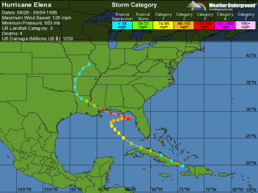
Five Years Ago
On this date five years ago I was monitoring four weather sites, the local radio, and the NOAA radio for news about a storm in the Gulf – Katrina.
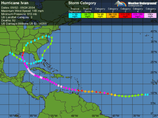
We had already been smacked by Dennis, which was a bigger mess than necessary because thanks to stalling by FEMA, we hadn’t managed to clean up from Ivan the year before, and now we were faced with another one.
On the 25th Mustang Bobby live-blogged Katrina coming ashore in South Florida [until his power failed at 8:15] as a Cat 1 hurricane after popping up the Bahamas, and the passage over the Everglades hadn’t weakened the storm appreciably. When it came into the Gulf the water was hot, in the 80s, so it had plenty of energy to build on and a minimum of wind sheer.
At around 1PM on the 28th Katrina was about 300 miles South-Southwest of me when the winds peaked at 175 mph and the pressure dropped to 902 mb, moving into the list of the five most powerful storms ever seen in the Atlantic Basin.
Having reached its maximum strength it began its relentless march to the North, building up a huge storm surge in front of it. If it had come at angle some of the surge might have slid off to the side, but couldn’t happen on the path that Katrina took. That’s why, even though we were about 200 miles East of the landfall, we had an 8-foot surge.
Katrina’s winds dropped to Category 3 strength before landfall, but the massive surge didn’t diminish at all. Waveland, Mississippi wasn’t blown away, it was washed away by the surge.
August 28, 2010 Comments Off on Five Years Ago


