
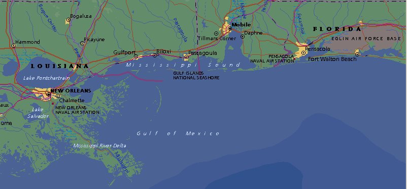
A Map of the Area
To give people an idea of the problems involved in the relief effort I’ve loaded a good-sized map of the Gulf Coast with all of the four-lane or larger roads on it as well as all of the towns larger than 10,000 people.
The roads that seem to end are because of the switch to two lanes. You will notice that there are few North-South roads and too many roads run right along the coast. You will also see the number of bridges required to cross the bays, rivers, and lakes.
It is 200 miles as the crow flies from Fort Walton Beach to New Orleans.
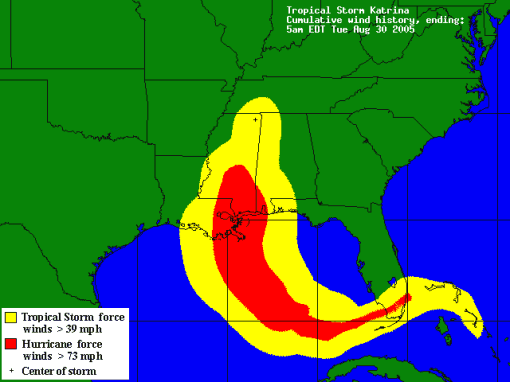
Update: I’ve put up the wind map for Katrina from the National Hurricane Center.


