
Category — Hurricanes
Potential Tropical Cyclone Sixteen
 Position: 29.5N 75.3W [10:00PM CDT 0300 UTC].
Movement: North-Northeast [015°] near 3 mph [ 6 kph].
Maximum sustained winds: 40 mph [ 65 kph].
Wind Gusts: 50 mph [ 80 kph].
Tropical Storm Wind Radius: 240 miles (390 km].
Minimum central pressure: 1007 mb ↓.
Currently about 355 miles [ 570 km] Southeast of Charleston, South Carolina.
A Tropical Storm Warning is in effect from Cape Fear, North Carolina, northward to Fenwick Island, Delaware, including Albemarle and Pamlico Sounds; the Chesapeake Bay south of North Beach; Tidal Potomac south of Cobb Island.
A Storm Surge Warning is in effect from Duck, North Carolina, to Chincoteague, Virginia, including Chesapeake Bay south of Windmill Point; for the Neuse River, the Pamlico River, and portions of Albemarle and Pamlico Sounds.
A Storm Surge Watch is in effect from Surf City, North Carolina to Duck, North Carolina; the Chesapeake Bay north of Windmill Point to Smith Point, including the remainder of Albemarle and Pamlico Sounds.
Here’s the link for NOAA’s latest satellite images.
[For the latest information click on the storm symbol, or go to the CATEGORIES drop-down box below the CALENDAR and select “Hurricanes” for all of the posts related to storms on this site.]
September 21, 2023 Comments Off on Potential Tropical Cyclone Sixteen
Hurricane Nigel – Day 7
 Position: 45.1N 36.7W [10:00PM CDT 0300 UTC].
Movement: East-Northeast [065°] near 37 mph [59 kph].
Maximum sustained winds: 75 mph [150 kph].
Wind Gusts: 90 mph [145 kph].
Tropical Storm Wind Radius: 230 miles [370 km].
Hurricane Wind Radius: 70 miles [110 km].
Minimum central pressure: 979 mb ↑.
Currently about 700 miles [1125 km] Northwest of the Azores.
Here’s the link for NOAA’s latest satellite images.
[For the latest information click on the storm symbol, or go to the CATEGORIES drop-down box below the CALENDAR and select “Hurricanes” for all of the posts related to storms on this site.]
September 21, 2023 Comments Off on Hurricane Nigel – Day 7
Hurricane Nigel – Day 6
Position: 39.0N 50.4W [10:00PM CDT 0300 UTC].
Movement: Northeast [045°] near 25 mph [41 kph].
Maximum sustained winds: 90 mph [150 kph].
Wind Gusts: 100 mph [160 kph].
Tropical Storm Wind Radius: 160 miles [260 km].
Hurricane Wind Radius: 60 miles [ 95 km].
Minimum central pressure: 973 mb.
Currently about 550 miles [ 885 km] South-Southeast of Cape Race, Newfoundland.
Here’s the link for NOAA’s latest satellite images.
[For the latest information click on the storm symbol, or go to the CATEGORIES drop-down box below the CALENDAR and select “Hurricanes” for all of the posts related to storms on this site.]
September 20, 2023 Comments Off on Hurricane Nigel – Day 6
Hurricane Nigel – Day 5
 Position: 33.2N 54.7W [10:00PM CDT 0300 UTC].
Movement: North [355°] near 15 mph [24 kph].
Maximum sustained winds: 100 mph [155 kph].
Wind Gusts: 110 mph [175 kph].
Tropical Storm Wind Radius: 175 miles [280 km].
Hurricane Wind Radius: 60 miles [ 95 km].
Minimum central pressure: 971 mb ↓.
Currently about 590 miles [ 950 km] East of Bermuda.
Here’s the link for NOAA’s latest satellite images.
[For the latest information click on the storm symbol, or go to the CATEGORIES drop-down box below the CALENDAR and select “Hurricanes” for all of the posts related to storms on this site.]
September 19, 2023 Comments Off on Hurricane Nigel – Day 5
Hurricane Nigel – Day 4
Position: 28.6N 52.7W [10:00PM CDT 0300 UTC].
Movement: Northwest [320°] near 12 mph [19 kph].
Maximum sustained winds: 85 mph [140 kph].
Wind Gusts: 95 mph [155 kph].
Tropical Storm Wind Radius: 160 miles [260 km].
Hurricane Wind Radius: 30 miles [ 45 km].
Minimum central pressure: 982 mb ↓.
Currently about 765 miles [1230 km] East-Southeast of Bermuda.
Here’s the link for NOAA’s latest satellite images.
[For the latest information click on the storm symbol, or go to the CATEGORIES drop-down box below the CALENDAR and select “Hurricanes” for all of the posts related to storms on this site.]
September 18, 2023 Comments Off on Hurricane Nigel – Day 4
Post-Tropical Cyclone Lee – Day 13
 Position: 48.0N 62.0W [10:00AM CDT 1500 UTC].
Movement: Northeast [020°] near 22 mph [35 kph].
Maximum sustained winds: 45 mph [ 75 kph].
Wind Gusts: 55 mph [ 90 kph].
Tropical Storm Wind Radius: 290 miles [465 km].
Minimum central pressure: 989 mb ↑.
Currently about 135 miles [ 215 km] West-Northwest of Port aux Basques, Newfoundland.
Environment Canada has discontinued all Tropical Storm Warnings for
Canada.
This is the last public advisory issued by the National Hurricane
Center on this system.
Here’s the link for NOAA’s latest satellite images.
[For the latest information click on the storm symbol, or go to the CATEGORIES drop-down box below the CALENDAR and select “Hurricanes” for all of the posts related to storms on this site.]
September 17, 2023 Comments Off on Post-Tropical Cyclone Lee – Day 13
Post-Tropical Cyclone Margot – Day 11
Position: 34.6N 42.4W [10:00AM CDT 1500 UTC].
Movement: West-Northwest [300°] near 9 mph [15 kph].
Maximum sustained winds: 40 mph [ 65 kph].
Wind Gusts: 50 mph [ 80 kph].
Tropical Storm Wind Radius: 105 miles (165 km].
Minimum central pressure: 1001 mb ↑.
Currently about 885 miles [1430 km] West of the Azores.
The National Hurricane Center has issued its last public advisory on this system.
Here’s the link for NOAA’s latest satellite images.
[For the latest information click on the storm symbol, or go to the CATEGORIES drop-down box below the CALENDAR and select “Hurricanes” for all of the posts related to storms on this site.]
September 17, 2023 Comments Off on Post-Tropical Cyclone Margot – Day 11
Tropical Storm Nigel – Day 3
 Position: 25.8N 50.2W [10:00PM CDT 0300 UTC].
Movement: North-Northwest [330°] near 12 mph [19 kph].
Maximum sustained winds: 70 mph [110 kph].
Wind Gusts: 80 mph [130 kph].
Tropical Storm Wind Radius: 140 miles [220 km].
Minimum central pressure: 992 mb ↓.
Currently about 990 miles [1590 km] East-Southeast of Bermuda.
Here’s the link for NOAA’s latest satellite images.
[For the latest information click on the storm symbol, or go to the CATEGORIES drop-down box below the CALENDAR and select “Hurricanes” for all of the posts related to storms on this site.]
September 17, 2023 Comments Off on Tropical Storm Nigel – Day 3
Lee 9/16 11AM
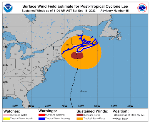
September 16, 2023 Comments Off on Lee 9/16 11AM
Post-Tropical Cyclone Lee – Day 12
Position: 45.3N 65.5W [10:00PM CDT 0300 UTC].
Movement: North-Northeast [020°] near 14 mph [22 kph].
Maximum sustained winds: 60 mph [ 95 kph].
Wind Gusts: 70 mph [115 kph].
Tropical Storm Wind Radius: 290 miles [465 km].
Minimum central pressure: 979 mb.
Currently about 105 miles [ 170 km] West-Northwest of Halifax, Nova Scotia.
A Tropical Storm Warning is in effect for New Brunswick from the Fundy National Park to Fort Lawrence and from Tidnish to Shediac including Grand Manan Island; Nova Scotia from Fort Lawrence to Avonport and then east from Lower East Pubnico to Tidnish; Prince Edward Island; Magdalen Islands.
Here’s the link for NOAA’s latest satellite images.
[For the latest information click on the storm symbol, or go to the CATEGORIES drop-down box below the CALENDAR and select “Hurricanes” for all of the posts related to storms on this site.]
September 16, 2023 Comments Off on Post-Tropical Cyclone Lee – Day 12
Tropical Storm Margot – Day 10
Position: 33.9N 40.5W [10:00PM CDT 0300 UTC].
Movement: West [260°] near 8 mph [13 kph].
Maximum sustained winds: 45 mph [ 85 kph].
Wind Gusts: 55 mph [ 90 kph].
Tropical Storm Wind Radius: 185 miles (295 km].
Minimum central pressure: 999 mb ↑.
Currently about 805 miles [1295 km] West-Southwest of the Azores.
Here’s the link for NOAA’s latest satellite images.
[For the latest information click on the storm symbol, or go to the CATEGORIES drop-down box below the CALENDAR and select “Hurricanes” for all of the posts related to storms on this site.]
September 16, 2023 Comments Off on Tropical Storm Margot – Day 10
Tropical Storm Nigel – Day 2
Position: 22.0N 48.0W [10:00PM CDT 0300 UTC].
Movement: Northwest [325°] near 16 mph [26 kph].
Maximum sustained winds: 40 mph [ 65 kph].
Wind Gusts: 50 mph [ 80 kph].
Tropical Storm Wind Radius: 90 miles [150 km].
Minimum central pressure: 1005 mb ↓.
Currently about 980 miles [1580 km] East-Northeast of the Lesser Antilles.
Here’s the link for NOAA’s latest satellite images.
[For the latest information click on the storm symbol, or go to the CATEGORIES drop-down box below the CALENDAR and select “Hurricanes” for all of the posts related to storms on this site.]
September 16, 2023 Comments Off on Tropical Storm Nigel – Day 2
Hurricane Lee – Day 11
Position: 39.5N 65.8W [10:00PM CDT 0300 UTC].
Movement: North-Northeast [015°] near 20 mph [31 kph].
Maximum sustained winds: 80 mph [130 kph].
Wind Gusts: 90 mph [145 kph].
Tropical Storm Wind Radius: 345 miles [555 km].
Hurricane Wind Radius: 115 miles [185 km].
Minimum central pressure: 965 mb.
Currently about 250 miles [ 405 km] East-Southeast of Nantucket, Massachusetts.
Tropical Storm force winds are arriving in Massachusetts and Nova Scotia at 10PN CDT.
A Tropical Storm Warning is in effect for Westport, Massachusetts northward to the U.S./Canada border; Martha’s Vineyard; Nantucket; New Brunswick from the U.S./Canada border to Fort Lawrence, including Grand Manan Island; Nova Scotia from Fort Lawrence to Point Tupper; New Brunswick from Shediac to Tidnish.
A Hurricane Watch is in effect for New Brunswick from the U.S./Canada border to Point Lepreau, including Grand Manan Island; Nova Scotia from Digby to Ecum Secum.
A Tropical Storm Watch is in effect for Prince Edward Island; Magdalen Islands; New Brunswick from Belledune to Shediac; Nova Scotia from Tidnish to Aulds Cove; Nova Scotia from Aulds Cove to Meat Cove to Point Tupper.
Here’s the link for NOAA’s latest satellite images.
[For the latest information click on the storm symbol, or go to the CATEGORIES drop-down box below the CALENDAR and select “Hurricanes” for all of the posts related to storms on this site.]
September 15, 2023 Comments Off on Hurricane Lee – Day 11
Tropical Storm Margot – Day 9
Position: 35.5N 38.0W [10:00PM CDT 0300 UTC].
Movement: South-Southwest [200°] near 5 mph [ 7 kph].
Maximum sustained winds: 65 mph [100 kph].
Wind Gusts: 75 mph [120 kph].
Tropical Storm Wind Radius: 300 miles (480 km].
Minimum central pressure: 990 mb.
Currently about 630 miles [1015 km] West-Southwest of the Azores.
Here’s the link for NOAA’s latest satellite images.
[For the latest information click on the storm symbol, or go to the CATEGORIES drop-down box below the CALENDAR and select “Hurricanes” for all of the posts related to storms on this site.]
September 15, 2023 Comments Off on Tropical Storm Margot – Day 9


