
Ig® Nobel Prize Winners for 2021
On the night of September 9th this year’s winners of Ig® Nobel Prizes were announced:
BIOLOGY PRIZE [SWEDEN]:
Susanne Schötz for analyzing variations in purring, chirping, chattering, trilling, tweedling, murmuring, meowing, moaning, squeaking, hissing, yowling, howling, growling, and other modes of cat–human communication.
WHO TOOK PART IN THE CEREMONY: Susanne Schötz
ECOLOGY PRIZE [SPAIN. IRAN]:
Leila Satari, Alba Guillén, Àngela Vidal-Verdú, and Manuel Porcar, for using genetic analysis to identify the different species of bacteria that reside in wads of discarded chewing gum stuck on pavements in various countries.
WHO TOOK PART IN THE CEREMONY: Leila Satari, Alba Guillén, Àngela Vidal-Verdú, Manuel Porcar
CHEMISTRY PRIZE [GERMANY, UK, NEW ZEALAND, GREECE, CYPRUS, AUSTRIA]:
Jörg Wicker, Nicolas Krauter, Bettina Derstroff, Christof Stönner, Efstratios Bourtsoukidis, Achim Edtbauer, Jochen Wulf, Thomas Klüpfel, Stefan Kramer, and Jonathan Williams, for chemically analyzing the air inside movie theaters, to test whether the odors produced by an audience reliably indicate the levels of violence, sex, antisocial behavior, drug use, and bad language in the movie the audience is watching.
WHO TOOK PART IN THE CEREMONY: Jörg Wicker, Nicolas Krauter, Bettina Derstroff, Christof Stönner, Efstratios Bourtsoukidis, Achim Edtbauer, Jochen Wulf, Thomas Klüpfel, Stefan Kramer, Jonathan Williams
[Read more →]
September 10, 2021 22 Comments
Worse Than I Thought
 I wrote too soon about oil spills caused by Ida. As the pictures of the oil-covered wildlife start to appear and the requests for old towels and Dawn ratchet up I read that the U.S. Coast Guard is investigating nearly 350 reported oil spills after Hurricane Ida:
The U.S. Coast Guard said it’s investigating reports of nearly 350 oil spill incidents in the aftermath of Hurricane Ida. The Category 4 storm, which hit Louisiana last month, shut down nearly 95% of the region’s crude oil and gas production.
“Coast Guard crews from across the nation…have deployed throughout Southeastern Louisiana to conduct hazard assessments in order to identify and prioritize threats to the environment and navigable waterways,” the Coast Guard said in a statement. “These assessments are essential to ensuring waterways are safe for marine traffic and ensuring that potential pollution hazards are expeditiously identified and mitigated.”
The volunteers are jumping into boats and scouring the area to pick up critters covered in crude to take back to wildlife rehab centers in hopes that some can be saved.
September 10, 2021 Comments Off on Worse Than I Thought
Hurricane Larry – Day 11
 Position: 46.8N 54.9W [10:00PM CDT 0300UTC].
Movement: North-Northeast [030°] near 47 mph [76 kph].
Maximum sustained winds: 80 mph [130 kph].
Wind Gusts: 100 mph [160 kph].
Tropical Storm Wind Radius: 255 miles [405 km].
Hurricane Wind Radius: 105 miles [165 km].
Minimum central pressure: 958 mb.
Currently about 85 miles [ 135 km] West of Cape Race, Newfoundland.
A Hurricane Warning is in effect from Arnold’s Cove to Jones Harbour, Newfoundland.
A Tropical Storm Warning is in effect from Francois to west of Arnold’s Cove, and from north of Jones Harbour to Fogo Island, Newfoundland.
Here’s the link for NOAA’s latest satellite images.
[For the latest information click on the storm symbol, or go to the CATEGORIES drop-down box below the CALENDAR and select “Hurricanes” for all of the posts related to storms on this site.]
September 10, 2021 Comments Off on Hurricane Larry – Day 11
Hurricane Larry – Day 10
Position: 35.5N 62.3W [10:00PM CDT 0300UTC].
Movement: North [360°] near 25 mph [41 kph].
Maximum sustained winds: 90 mph [150 kph].
Wind Gusts: 110 mph [175 kph].
Tropical Storm Wind Radius: 230 miles [370 km].
Hurricane Wind Radius: 90 miles [150 km].
Minimum central pressure: 966 mb.
Currently about 265 miles [ 425 km] North-Northeast of Bermuda.
A Hurricane Warning is in effect from Arnold’s Cove to Jones Harbour, Newfoundland.
A Tropical Storm Warning is in effect from Lamaline to west of Arnold’s Cove, and from north of Jones Harbour to Bonavista, Newfoundland.
Here’s the link for NOAA’s latest satellite images.
[For the latest information click on the storm symbol, or go to the CATEGORIES drop-down box below the CALENDAR and select “Hurricanes” for all of the posts related to storms on this site.]
September 9, 2021 Comments Off on Hurricane Larry – Day 10
Post-Tropical Cyclone Mindy – Day 2
 Position: 32.5N 75.0W [10:00PM CDT 0300UTC].
Movement: East-Northeast [070°] near 29 mph [46 kph].
Maximum sustained winds: 35 mph [ 55 kph].
Wind Gusts: 45 mph [ 70 kph].
Minimum central pressure: 1005 mb.
Currently about 285 miles [ 460 km] East of Charleston, South Carolina.
This is the last public advisory issued by the National Hurricane Center on this system.
Here’s the link for NOAA’s latest satellite images.
[For the latest information click on the storm symbol, or go to the CATEGORIES drop-down box below the CALENDAR and select “Hurricanes” for all of the posts related to storms on this site.]
September 9, 2021 Comments Off on Post-Tropical Cyclone Mindy – Day 2
Tropical Storm Mindy
 Position: 29.9N 84.5W [10:00PM CDT 0300UTC].
Movement: Northeast [055°] near 20 mph [31 kph].
Maximum sustained winds: 45 mph [ 75 kph].
Wind Gusts: 55 mph [ 90 kph].
Tropical Storm Wind Radius: 45 miles [ 75 km].
Minimum central pressure: 1002 mb ↓.
Currently about 35 miles [ 55 km] East-Northeast of Apalachicola, Florida.
A Tropical Storm Warning is in effect from Indian Pass to Steinhatchee River, Florida.
The storm made landfall on St. Vincent Island, Florida at 8:15PM CDT
Here’s the link for NOAA’s latest satellite images.
[For the latest information click on the storm symbol, or go to the CATEGORIES drop-down box below the CALENDAR and select “Hurricanes” for all of the posts related to storms on this site.]
September 8, 2021 Comments Off on Tropical Storm Mindy
Hurricane Larry – Day 9
 Position: 29.7N 60.3W [10:00PM CDT 0300UTC].
Movement: North-Northwest [330°] near 16 mph [26 kph].
Maximum sustained winds: 100 mph [155 kph].
Wind Gusts: 120 mph [195 kph].
Tropical Storm Wind Radius: 240 miles [390 km].
Hurricane Wind Radius: 90 miles [150 km].
Minimum central pressure: 969 mb ↑.
Currently about 320 miles [ 515 km] East-Southeast of Bermuda.
A Tropical Storm Warning is in effect for Bermuda.
Here’s the link for NOAA’s latest satellite images.
[For the latest information click on the storm symbol, or go to the CATEGORIES drop-down box below the CALENDAR and select “Hurricanes” for all of the posts related to storms on this site.]
September 8, 2021 Comments Off on Hurricane Larry – Day 9
Hurricane Larry – Day 8
 Position: 25.8N 56.8W [10:00PM CDT 0300UTC].
Movement: Northwest [325°] near 12 mph [19 kph].
Maximum sustained winds: 115 mph [185 kph].
Wind Gusts: 140 mph [225 kph].
Tropical Storm Wind Radius: 185 miles [295 km].
Hurricane Wind Radius: 70 miles [110 km].
Minimum central pressure: 967 mb ↑.
Currently about 660 miles [1060 km] Southeast of Bermuda.
A Tropical Storm Watch is in effect for Bermuda.
Here’s the link for NOAA’s latest satellite images.
[For the latest information click on the storm symbol, or go to the CATEGORIES drop-down box below the CALENDAR and select “Hurricanes” for all of the posts related to storms on this site.]
September 7, 2021 Comments Off on Hurricane Larry – Day 8
L’shanah Tovah
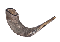
September 6, 2021 Comments Off on L’shanah Tovah
Hurricane Larry – Day 7
Position: 23.1N 54.4W [10:00PM CDT 0300UTC].
Movement: Northwest [325°] near 10 mph [17 kph].
Maximum sustained winds: 125 mph [205 kph].
Wind Gusts: 155 mph [250 kph].
Tropical Storm Wind Radius: 185 miles [295 km].
Hurricane Wind Radius: 70 miles [110 km].
Minimum central pressure: 956 mb.
Currently about 900 miles [1445 km] Southeast of Bermuda.
Here’s the link for NOAA’s latest satellite images.
[For the latest information click on the storm symbol, or go to the CATEGORIES drop-down box below the CALENDAR and select “Hurricanes” for all of the posts related to storms on this site.]
September 6, 2021 Comments Off on Hurricane Larry – Day 7
Labor Day
In any celebration of Labor Day I’m at a slight disadvantage because for a big chunk of my life it was celebrated as May Day where I was living.
It is rather unique, as it is the only holiday I’m aware of that was imported from Canada where it’s spelled Labour Day.
When I was an elementary school student, it marked the end of summer and beginning of school, but it is a rare holiday in the South as there is no tradition of blowing things up in celebration. There is also no tradition of honoring labor in the South, and labor unions are considered communist conspiracies.
September 6, 2021 Comments Off on Labor Day
Gulf Gusher 2
Just another reminder why it is a very bad idea to have oil wells and pipelines off the coast in hurricane prone areas. The petroleum industry is a major cause of climate change and the offshore wells make matters even worse. Rush to contain large oil spill in Gulf of Mexico after Storm Ida:
The source of the miles-long oil spill was believed to be in the Bay Marchand area of the Gulf of Mexico, the US Coast Guard said.
Spokesman Lt. John Edwards said it was thought to be crude oil from an undersea pipeline owned by Talos Energy.
Houston-based Talos Energy said it did not believe it was responsible for the oil in the water, according to the Associated Press.
It’s not Talos Energy’s fault but they rushed to hire a clean-up crew out of the goodness of their hearts. It may not be their pipeline, but they don’t want penalties on top of clean-up costs.
September 5, 2021 Comments Off on Gulf Gusher 2
Hurricane Larry – Day 6
Position: 21.0N 51.4W [10:00PM CDT 0300UTC].
Movement: Northwest [310°] near 12 mph [19 kph].
Maximum sustained winds: 125 mph [205 kph].
Wind Gusts: 155 mph [250 kph].
Tropical Storm Wind Radius: 175 miles [280 km].
Hurricane Wind Radius: 70 miles [110 km].
Minimum central pressure: 955 mb.
Currently about 1135 miles [1825 km] Southeast of Bermuda.
Here’s the link for NOAA’s latest satellite images.
[For the latest information click on the storm symbol, or go to the CATEGORIES drop-down box below the CALENDAR and select “Hurricanes” for all of the posts related to storms on this site.]
September 5, 2021 Comments Off on Hurricane Larry – Day 6
Hurricane Larry – Day 5
Position: 18.0N 48.0W [10:00PM CDT 0300UTC].
Movement: West-Northwest [300°] near 14 mph [22 kph].
Maximum sustained winds: 120 mph [195 kph].
Wind Gusts: 150 mph [240 kph].
Tropical Storm Wind Radius: 160 miles [260 km].
Hurricane Wind Radius: 45 miles [ 75 km].
Minimum central pressure: 958 mb.
Currently about 1440 miles [2315 km] Southeast of Bermuda.
Here’s the link for NOAA’s latest satellite images.
[For the latest information click on the storm symbol, or go to the CATEGORIES drop-down box below the CALENDAR and select “Hurricanes” for all of the posts related to storms on this site.]
September 4, 2021 Comments Off on Hurricane Larry – Day 5


